
 Posted by
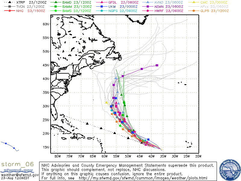 What looks to me one of the more powerful tropical storms of the 2010 Atlantic hurricane season, Tropical Storm Danielle continues churning in the Eastern Atlantic Ocean as this article is written. Even though the National Hurricane Center in Miami Florida predicts the Storm to become a Major Hurricane within the next 48 hours, most interests along the East Coast and Gulf of Mexico can let their guard down somewhat.
The Predicted path of the storm puts it somewhere well east of the island of Bermuda come the end of this week and weekend. Almost all computer models show the storm recurving to the north, missing the United states by over 1500 miles, and likely not affecting any major land masses. We have provided a map of the various tropical storm models that the meteorologists use to make their forecasts. As you can see they are in good agreement. Remember though, that tropical systems often have a mind of their own and things can change in a heartbeat. Always keep at least one eye on the tropics if you live in an area that can be affected.
